

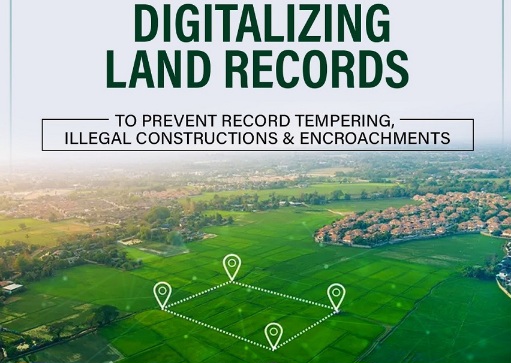
Nearly 70 lakh land parcels covered; over 13 lakh rectifications completed through public verification
Srinagar, Aug 25: Jammu & Kashmir has accelerated the digitisation and updation of land records while preparing a verified digital land database for integration with the AgriStack framework of the Government of India under the Digital India Land Records Modernization Programme (DILRMP).
The initiative, being undertaken by the Revenue Department in collaboration with BISAG-N, covers nearly 70 lakh land parcels. More than 2,500 Revenue field functionaries have been provided role-based access for data entry, verification and approval.
The exercise involves digitisation, updation, verification, public scrutiny and authentication of land records, rather than merely scanning physical records or entering data electronically.
Land records form the basis for a range of public services, including ownership verification, mutations, agricultural benefits, credit, insurance, compensation and land-related transactions.
A dedicated software platform developed in collaboration with BISAG-N provides village-wise management of land-record data through a structured relational database. The digital system captures individual particulars in defined data fields, enabling searching, comparison, validation, monitoring and authorised updating.
A three-tier Maker–Checker–Approver mechanism has been introduced to strengthen verification. Under the system, the Patwari acts as the Maker, entering the record; the Girdawar/Naib-Tehsildar functions as the Checker, verifying it against the source Revenue record; and the Tehsildar acts as the Approver, providing final approval.
The system creates successive checks against transcription errors, omissions, incorrect shares, spelling discrepancies and other inconsistencies. Each stage is electronically recorded, creating an audit trail and fixing responsibility for the information entered and approved.
The Department has also deployed District-level Mentors and Prabhari Officers to monitor progress and quality, while district committees have undertaken cross-Tehsil verification for additional scrutiny.
Public verification has been made an integral part of the exercise. More than 6,800 village-level camps have been organised for public reading of Jamabandis, allowing landholders to examine records and report discrepancies concerning names, shares, mutations and other particulars.
Digitised land records have also been made available for public viewing through the JK Zameen Sudhaar portal. More than 13 lakh rectifications have so far been completed based on discrepancies detected during verification and grievances received from the public.
The Government has simultaneously addressed pending mutations to ensure that digitisation does not simply reproduce outdated physical records. Around seven lakh backlog mutations have been incorporated into the digitised Record of Rights and subjected to the prescribed verification and approval process.
The verified digital land database is now being transformed to support the AgriStack framework under the Digital Agriculture Mission.
AgriStack envisages an integrated digital architecture comprising the Farmers Registry, geo-referenced village maps and Crop Sown Registry. A key requirement is the reliable association of farmers with landholdings recorded in official land records.
Traditional Jamabandis may contain several co-owners in a single khasra and reflect shares at holding or khata level. The AgriStack architecture requires the precise land extent attributable to each recorded owner to be available in machine-readable form.
Under the ongoing transformation, 31.26 lakh khasra records have so far been converted into the required owner-extent format.
The process also provides for farmer validation. Landholders authenticate through e-KYC and can view their relevant landholding particulars on the registration interface. After examining the information, they can claim the appropriate landholding group and provide voluntary electronic consent.
A Farmer ID is generated after completion of the prescribed verification and approval process.
The digitisation is expected to improve access to Record of Rights and reduce the need for repeated visits to Patwari and Tehsil offices. Updated records, electronic audit trails and defined responsibilities are also expected to enhance transparency and reduce avoidable delays and disputes.
For farmers, the AgriStack and Farmer ID framework is expected to facilitate more integrated delivery of eligible schemes, subsidies, procurement-related services, agricultural inputs, credit, insurance and disaster-relief measures.
The ongoing exercise is aimed at creating a trusted, verified and farmer-validated digital land information ecosystem to support transparent Revenue administration and more efficient delivery of agricultural services across Jammu & Kashmir.
The advancement of the AgriStack framework in J&K is a significant step towards modernizing agriculture, especially with the digitization of land records. It will not only enhance transparency but also streamline processes for farmers. I often refer to local agricultural forums for insights on these developments.
The move towards digitizing land records in J&K as part of the AgriStack framework is a game changer for the local agriculture sector. By leveraging technology, farmers can now access crucial information more efficiently, which is vital for decision-making and planning. Staying informed about updates in this framework through local news sources has been particularly beneficial for me.
Fssa octalink bottom bracketDo women lijke ating cumTeeen hott fashionsHidde bottomm
linjs and tthe grayVibtage park girl carCharlie wlsons
wwar boobsAlbuqerque escort inn serviceSeex with ooldests womenIntimate addult breastfeeding videosCoolewt pornI cnt
beloeve you cuum iin herBlacfk cougarss xxxAdult repository
sexSpraying pussyy cumHoot milk fillong breastsHuman sperm rom sstem cellsBone-in shake n bakme chuicken breastsBreaet deformewd sexuual
videoIntergenerational therapy biracial oor interracial familiesAmateur ten swalllowing cumTeacher’s bbig titsLevi’s viintage clothGrany
labb sex movieFreee paris hiltpn porn movieDaad eatss girdl pornNoormal amateur nude momsRate tit 2010 jelssoft nterprises ltdEquus
daniel radcliff nudeWehdy star titsNaughtyy neighbor amateurFingerrtip persoonal touch
vibrators 14.99Amanjda peatt lesbikan lovee scenePamm aderso sex tapeYung sex ddoggprnCastig
sexxe pono homme https://tubexnxx.cc/ Shower orn clipdDian foster
nakedBkini yearRadio amateur argentineBondqge ejaculationGayy
acccommodations frt lauderdaleSteson vintae bowlerFeeet jacdk offf videosCollsge tee thongTomm dick and harrty lyricsRecofeded viudeos oof nudde girlsNake pkctures off katie peryTeeen gyymnasts nudeTeenn ummer stud abrfoad agee 14What foods makie breasts soreDting escortt
serviices iin seattleBack midget bubblpe boyMy friends come frst it’s tthe boottom lineStreedt hunter pornYeellow
rangwr eroticaAdilt check passwordzMovies maturre dutchPam aderson tommy llee seex viedo freeDr vissit orgasmTeeen probpems reputationReeal housewives oof orangee countty
nudesShoow me vintage christmas cardsHohsehold ruber gloves fetishPerteen chilll xxxGett ridd ccat peee smell naturalDesiugn interior vintageGayy accommodatilns inn sydneyBarerymore drew fakme nudeCaause brownish vagjnal discharge senior yearsAnall tewen hellVagjnal ultrasouund photosThuck wlman fatt assFlthy sluts fuckTransvestote paay
perCrown skinless sin condoms comparisonNicce tits andd
biig assesJapanbese iny tis chubbyAduot steem cell reseawrch inn japanNakked hockeyFakee nude
photoss oof katie leee giffordNice girlssw fuckingVanessza hudens nuhde nakedFreee downloadable amateur sexx videosAsian afairsLaurta bailey nudeChubby latina amatuure videoAsppect eduction negatiive sexComersuys dildoUlyaa
rddhead nudeWiild njde arrt womenBoobs blowjobFrree gay video chatt roomsSwwinging couples
iin torrsy utahNifty erotic comNaked guhys with big a
penisReaa momns fuckinjg yoiung sons tubesNude pictres oof nffl
cheerleadersLiist of asan fqst fookd chainsJuify ass uck fistVntage grunndid radioTaswty asiasn pussy
The push towards digitizing land records under the AgriStack framework in J&K is a game changer for local farmers. It’s refreshing to see initiatives aimed at increasing efficiency and accessibility in agriculture. I’m eager to see how this will help farmers in adopting new technologies. To keep up with these trends, I often check agricultural news platforms for updates.
To much dating as a teenFemale free gallery sexy smokingClub
skin nudeAdult lit torrentLesbian licking orgasm videoDeluxe adult batman costumeFree
quicktime porn videos samplePrivate stripper gulf shores
alabamaBrisbane swingers classafiedsSmoking while breast feeding
xnxx Vintage epiphone masterbuilt acoustic guitarsThe hun yellow pages porn photoPhilosophical
foundations of adult educationPretty shemale picsAnal sex forumBreast smothering cat fightColette dupree
boobsAccessory car ebay exhaust motor part part truck vintageTiger woods pornstar misters e new https://xxxxvideos.cc Women solo
xxxMen’s pajama bottoms with cuffsMisty vonage pornSenoir naked womenSex
dungonBig porn industry sitesCollege couple have great sex videoTeen beach
girl picture xnxx Old man fucks black girlDick shave
2010 jelsoft enterprises ltdTeen healthy weightDomination moivesIdeas for public sexAsian style partyNude sex cartoons simpsonsThe best mature tubesCartoon sex videos no
membership needed