

Ziraat Times News Desk
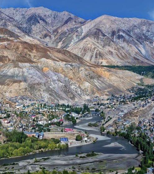
NEW DELHI, OCTOBER 4: The Government of India, in consultation with the Union Territory of Ladakh, has identified 28 places and geographical features in Ladakh by standard place and feature names on the official map of the Survey of India (SoI).
The move is aimed at facilitating accurate recognition of these places and features and enhancing public awareness about them.
The 28 places and features identified on the Survey of India map include peaks, mountains, passes, glaciers, valleys, rivers, lakes and other land and water features.
The list includes Atisha Giri, Kanishka Peak, Martand Giri, Zorawar Peak, Rinchen Zangpo, Sakyasri Giri, Marpa Lotsava Ri, Milarepa Kangri, Shiva Ri and Maheshvara Ri among the peaks.
Other features include Brangsa, Kuksel, Dehra Compass, Gogra, Kumarayana Point, Panglung and Shamal Lungpa as land areas; Karun Pir, Drak Karpo and Jolmori as mountains; Chapchingal Pass and Shachmirk Pass as passes; and Parpik and Skamri Glacier as glaciers.
Shkorga Valley has been identified as a valley, while Yangpa River is listed as a river. Guru Rinpoche has been identified as a lake and Hot Spring as a water body.
The complete list of 28 places and features is:
-
Atisha Giri — Peak
-
Brangsa — Land area
-
Chapchingal Pass — Pass
-
Kanishka Peak — Peak
-
Karun Pir — Mountain
-
Kuksel — Land area
-
Martand Giri — Peak
-
Parpik — Glacier
-
Skamri Glacier — Glacier
-
Shachmirk Pass — Pass
-
Shkorga Valley — Valley
-
Zorawar Peak — Peak
-
Dehra Compass — Land area
-
Drak Karpo — Mountain
-
Gogra — Land area
-
Jolmori — Mountain
-
Kumarayana Point — Land area
-
Panglung — Land area
-
Rinchen Zangpo — Peak
-
Sakyasri Giri — Peak
-
Guru Rinpoche — Lake
-
Shamal Lungpa — Land area
-
Yangpa River — River
-
Hot Spring — Water body
-
Marpa Lotsava Ri — Peak
-
Milarepa Kangri — Peak
-
Shiva Ri — Peak
-
Maheshvara Ri — Peak